

Hurricane Force Winds Possible In SE Wyoming, Red Flag Fire Warning
UPDATE I:45 p.m. Sunday: The Fire Watch has now been upgraded to a Red Flag Fire Warning:
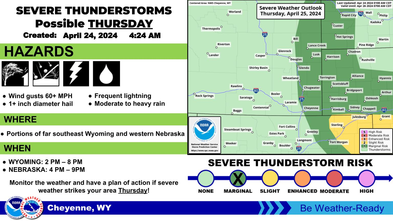
The Cheyenne Office of the National Weather Service says winds that could gust locally to over 75 miles per hour are possible in areas of southeast Wyoming until 6 p.m. on Monday.
Winds of 74 miles per hour or higher are generally considered ''hurricane force."
A Fire Danger Watch has also been posted due to the windy conditions.
The agency posted the following on its website:
Strong winds will continue through Monday for the usual prone areas of I-25 and I-80 in Wyoming. High wind gusts may also spread into Converse and eastern Platte Counties, prompting a Watch for Sunday. Be prepared for hazardous travel conditions, especially lightweight and high profile vehicles. Elevated fire weather conditions will also exist for areas without a snowpack.
Strong west winds the next couple days will help contribute to unseasonably mild or warm temperatures across far eastern Wyoming and western Nebraska. Highs will approach daily record values on Monday.
The combination of unseasonably warm temperatures, strong westerly winds, and very dry air may result in critical fire weather conditions Monday. The area of primary concern lies along and east of I-25. Any fire start will be capable of spreading rapidly and being difficult to control.
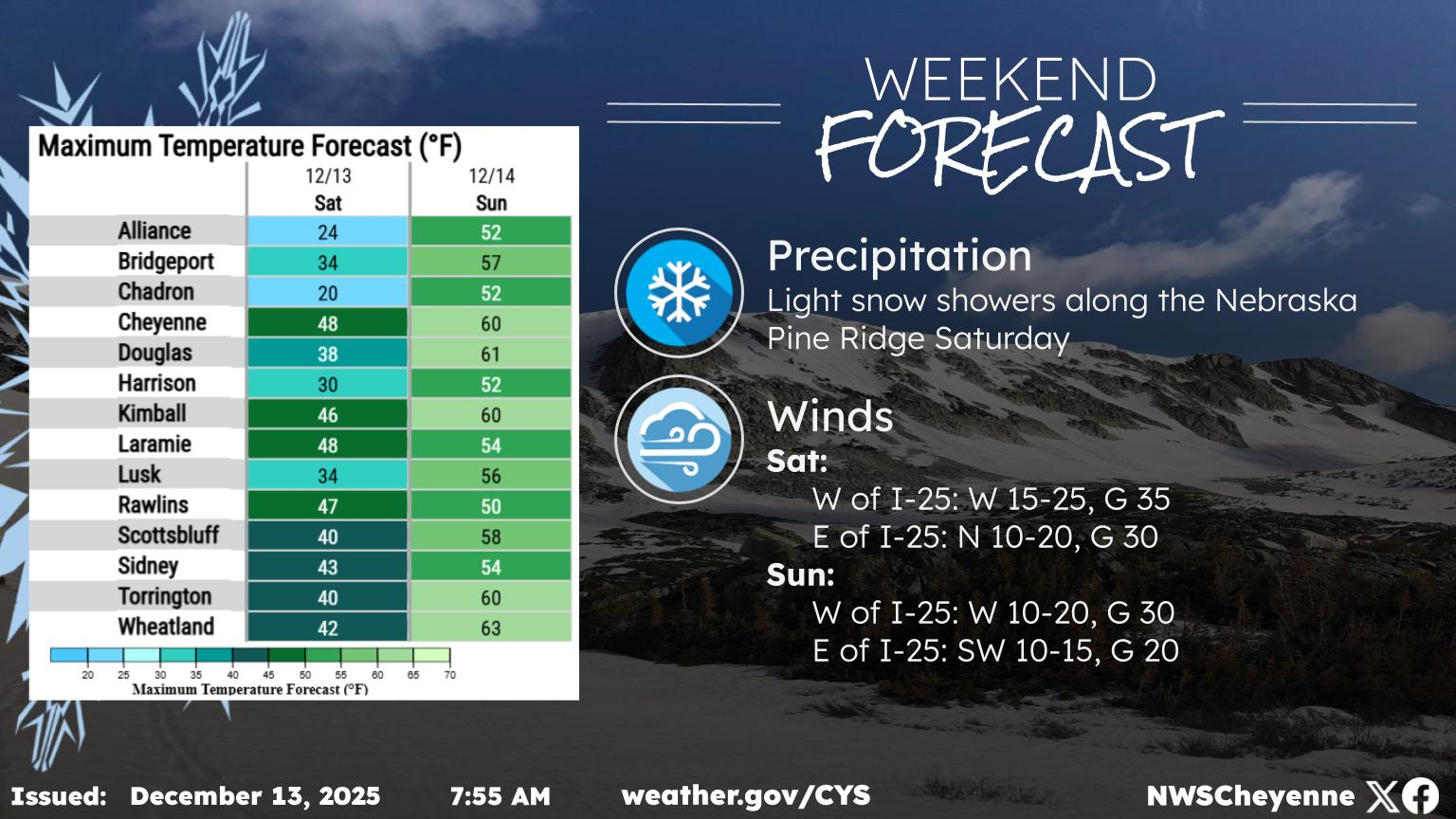
Cheyenne, Laramie Forecasts
Cheyenne Forecast
🌷 10 Colorful Things to Grow in your Zone 5 Garden
Gallery Credit: Kolby Fedore, Townsquare Media