

Snow Expected In SE Wyoming, Up To 10 Inches In Mountains
Southeast Wyoming can expect snow on Tuesday night and Wednesday, according to the Cheyenne Office of the National Weather Service.
While the snowfall should be fairly light at the lower elevations. Winter Weather Advisories have been issues for the Sierra Madres and Snowy Range Mountains.
The agency posted the following on its website :Another found of light snow will move into the area along a reinforcing cold front beginning Tuesday late afternoon into early Wednesday morning. For most, this will mean another dusting to an inch or two of snow by daybreak Wednesday. The mountains of southeast Wyoming will receive a little bit more snow accumulation (including during the day Tuesday), and a Winter Weather Advisory is in effect there. The graphics attached show the timeline of snowfall at the left, and the probability of 1" of snow at the right.
But the mountain areas could receive heavier snow: A Winter Weather Advisory has been issued for the Snowy and Sierra Madre ranges in southeast wyoming from 5AM Tuesday until 11AM Wednesday. Higher elevations can expect 5-10" of snow with the western side of the ranges favored.
 .A high wind warning is also in effect for some areas:
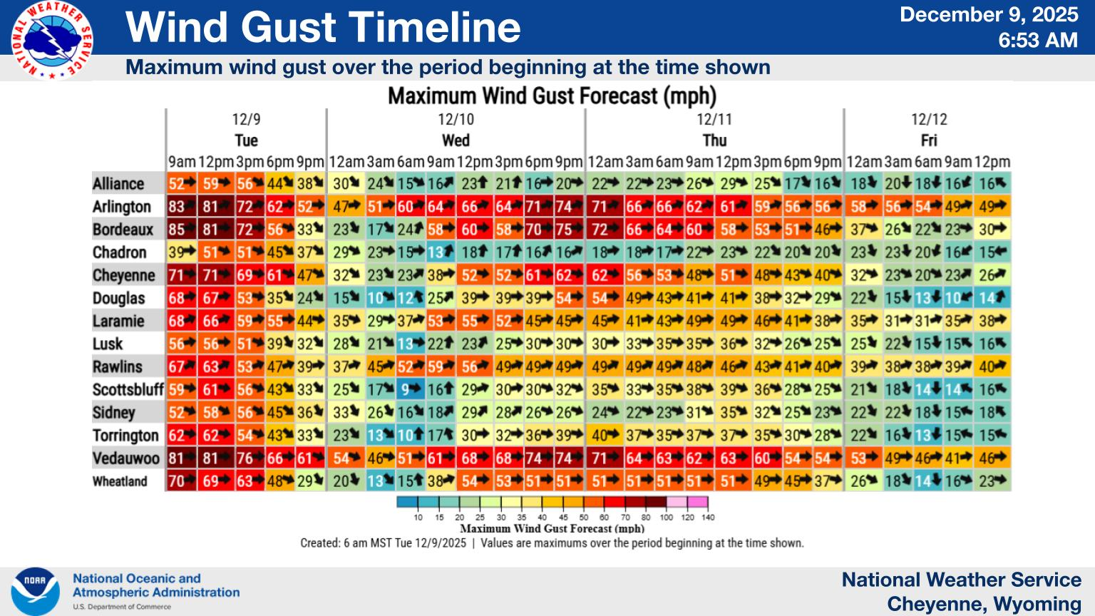
Another round of strong winds is expected this evening through Wednesday morning. Wind gusts of 65 to 70 mph are expected in the typical wind prone areas of southeast Wyoming. In addition, some areas of patchy blowing snow will be possible.
Cheyenne, Laramie Forecasts
Cheyenne Forecast