Cheyenne, Much OF SE Wyoming Now Facing Thursday Blizzard Warning
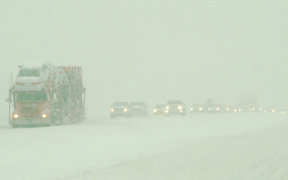
What had been a Winter Storm Watch for Cheyenne and much of Southeast Wyoming on Thursday has now been upgraded to a Blizzard Warning, according to the Cheyenne Office of the National Weather Service.
The agency sent out the following situation report at 6:30 am Tuesday...
The weather Impact Level for the upcoming Winter Storm is: High
Here are the current weather event impact highlights:
- Potent winter storm to impact the area beginning Wednesday evening. Areas of moderate to heavy snow likely across most of southeast Wyoming and western Nebraska.
- Winter Weather Advisories and Blizzard Warnings in effect for most of southeast Wyoming and all of western Nebraska beginning Wednesday night through Thursday night.
- North to northeast winds 25-35 mph with gusts to 50 mph expected across the High Plains, along and east of the Interstate 25 corridor, and along the I-80 Summit and Arlington areas.
Rain will start in the afternoon and evening on Wednesday. A wintry mix will bring a light coating of ice overnight, with precipitation changing over to snow before daybreak Thursday morning in the lower terrain. Widespread heavy snow for an extended period is possible on Thursday.
The areas covered by the blizzard warning are shown in bright orange on the map below:
![]()
More From Y95 Country

![Kelsea Ballerini Reveals the ‘Bold’ Way She Convinced Kenny Chesney to Be Her Duet Partner [WATCH]](http://townsquare.media/site/623/files/2020/03/kelsea-ballerini.jpg?w=980&q=75)