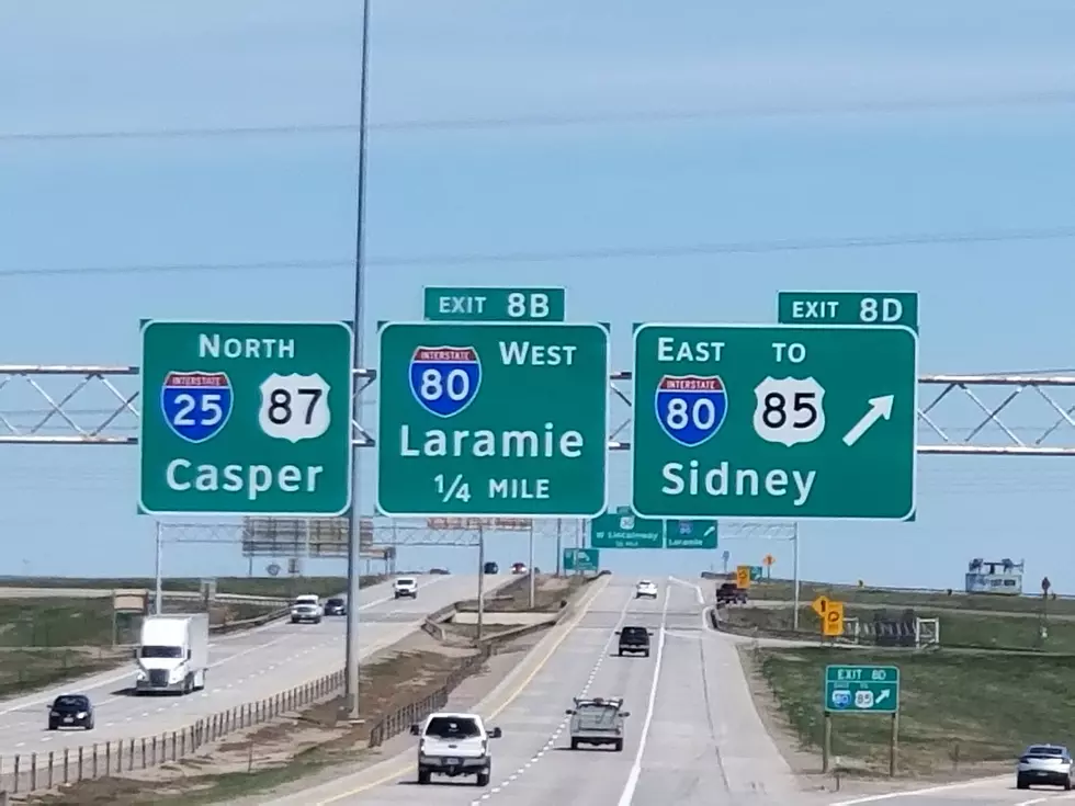
High Wind Warning For Cheyenne and Laramie Areas Saturday into Sunday
The National Weather Service has issued a High Wind Warning for parts of southeastern Wyoming, including the Cheyenne and Laramie areas and the Interstate 80 and 25 corridors.
A High Wind Warning means a hazardous high wind event is expected or occurring. Sustained wind speeds of at least 40 mph or gusts of 58 mph or more can lead to property damage.
The Weather Service said that the impacts will be mostly to transportation. "Strong crosswinds will be hazardous to light weight and high profile vehicles, including campers and tractor-trailers. There will be a high risk for vehicle blow overs, particularly along north to south oriented roadways."
URGENT - WEATHER MESSAGE
National Weather Service Cheyenne WY
1233 PM MST Sat Jan 2 2021

WYZ115-118-031200-
/O.UPG.KCYS.HW.A.0002.210103T1500Z-210104T0000Z/
/O.EXB.KCYS.HW.W.0001.210103T1500Z-210104T0000Z/
Laramie Valley-Central Laramie County-
Including the cities of Bosler, Laramie, and Cheyenne
1233 PM MST Sat Jan 2 2021

...HIGH WIND WARNING IN EFFECT FROM 8 AM TO 5 PM MST SUNDAY...

* WHAT...West winds 35 to 45 mph with gusts up to 70 mph
  expected.

* WHERE...Laramie Valley and Central Laramie County including
  Cheyenne and Laramie.

* WHEN...From 8 AM to 5 PM MST Sunday.

* IMPACTS...Mainly to transportation. Strong cross winds will be
  hazardous to light weight and high profile vehicles, including
  campers and tractor trailers. There will be a high risk for
  vehicle blow overs, particularly along north to south oriented
  roadways.

PRECAUTIONARY/PREPAREDNESS ACTIONS...

A High Wind Warning means a hazardous high wind event is expected
or occurring. Sustained wind speeds of at least 40 mph or gusts of
58 mph or more can lead to property damage.

Enter your number to get our free mobile app
KEEP READING: Scroll to see what the big headlines were the year you were born
More From Y95 Country
![‘2020 Sucks!’ Luke Bryan and Katy Perry Serenade the Year Out With Goofy Tune [Watch]](http://townsquare.media/site/204/files/2021/01/katy-perry-2020-sucks.jpg?w=980&q=75)