2-5 Inches of Snow, 65 MPH Gusts Possible on I-80 Summit
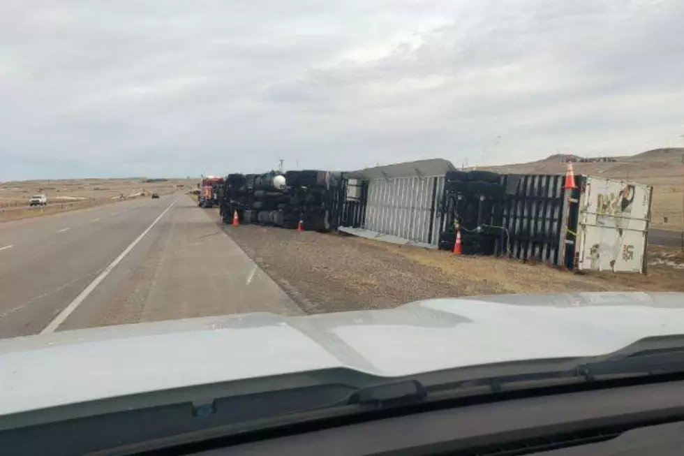
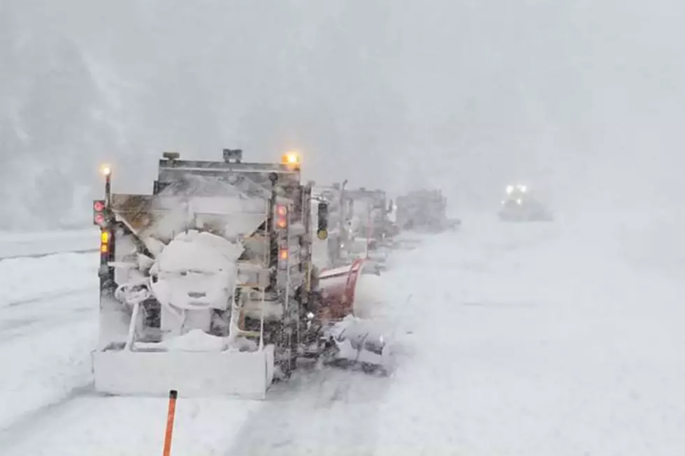
Two to five inches of snow coupled with winds gusting as high as 65 mph could make for whiteout conditions on the Interstate 80 Summit later today through Wednesday, according to the National Weather Service in Cheyenne.
A Winter Storm Warning is in effect for the area from 3 p.m. this afternoon until noon Wednesday.
URGENT - WINTER WEATHER MESSAGE
National Weather Service Cheyenne WY
416 AM MDT Tue Oct 12 2021

WYZ116-130015-
/O.UPG.KCYS.WS.A.0010.211012T2100Z-211013T1800Z/
/O.EXB.KCYS.WS.W.0016.211012T2100Z-211013T1800Z/
South Laramie Range-
Including the cities of Buford, Pumpkin Vine, and Vedauwoo
416 AM MDT Tue Oct 12 2021

...WINTER STORM WARNING IN EFFECT FROM 3 PM THIS AFTERNOON TO
NOON MDT WEDNESDAY...

* WHAT...Snow and blowing snow expected. Total snow accumulations
  of 2 to 5 inches. Winds gusting as high as 65 mph. Visibilities
  less than one half mile possible.

* WHERE...South Laramie Range including the Interstate 80 Summit
  between Laramie and Cheyenne.

* WHEN...3 PM MDT this afternoon until noon MDT Wednesday.

* IMPACTS...Dangerous travel conditions due to icy, snow covered
  roads and very low visibilities in falling and blowing snow.

PRECAUTIONARY/PREPAREDNESS ACTIONS...

If you must travel, keep an extra flashlight, food, and water in
your vehicle in case of an emergency.

The latest road conditions for the state you are calling from can
be obtained by calling 5 1 1.

6:30 AM October 12th – Here it is! First winter storm of the season will be developing today across the area as portions of central Wyoming already saw snowfall yesterday. As of early Tuesday morning, Rawlins and Douglas have reported snowfall which will continue throughout the day and tonight. Lower elevations west of I-25 could see rain mixed with snow before transitioning to all snow tonight. Widespread, heavy snowfall can be expected by later this afternoon into tonight with 4 to 10 inches of snowfall in the lower elevations of Carbon, Albany, and Converse Counties in Wyoming. Therefore, a Winter Storm Warning is in effect for the area through Wednesday morning. Most of the Nebraska Panhandle will be too warm to receive accumulating snowfall, however strong to severe thunderstorms with heavy rainfall are expected Tuesday afternoon and evening. Strong winds are likely to develop tonight and Wednesday morning across the South Laramie Range through the southern Nebraska Panhandle. Therefore, a High Wind Warning is in effect from 12 AM Wednesday through 6 PM Wednesday for 60 MPH wind gusts. For areas receiving measurable snowfall, these winds could result in whiteout conditions and hazardous travel, especially along Interstate 80 near Arlington/Elk Mountain and at the Summit between Cheyenne and Laramie. Be sure to have your winter safety car kit ready if you're traveling through the highlighted area above!
Drivers are encouraged to call 511 or go to wyoroad.info for the latest road conditions and closure information.
A Look Back At Cheyenne's Worst October Snow Storms
LOOK: The most expensive weather and climate disasters in recent decades
Gallery Credit: KATELYN LEBOFF
More From Y95 Country