94 MPH Wind Gust Recorded in Southeast Wyoming; High Wind Warnings in Effect
Winds have really been cranking across much of southeast Wyoming and the Nebraska Panhandle this morning, according to the National Weather Service in Cheyenne.
"(The) strongest wind gusts have been out by Arlington ... with the peak wind of 94 mph reported at the County Road 402 WYDOT site, 2.5 miles southeast of Elk Mountain," the NWS said.
5/645AM: Greetings! High Wind Warnings remain in effect for the entire forecast area through the next 24 hours. Winds have really been cranking across much of the forecast area this morning. Strongest wind gusts have been out by Arlington this morning, with the peak wind of 94 mph reported at the County Road 402 WYDOT site, 2.5 miles southeast of Elk Mountain. Strong winds to continue today. Please follow WYDOT's Road Condition Report at wyoroad.info/pls/Browse/WRR.STATIC5?SelectedDistrict=1 for the latest road status on Interstate 80 through the day. Be safe!

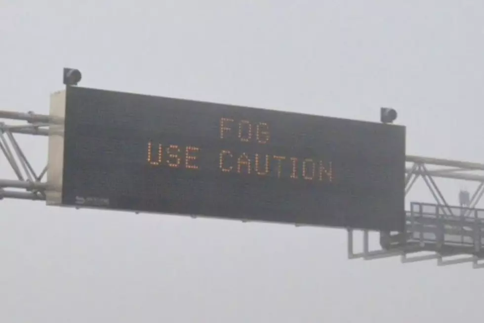
As of 9:33 a.m., Interstate 80 between Rawlins and Cheyenne and Interstate 25 between the Colorado state line and Cheyenne were closed to light, high-profile vehicles due to gusting winds.
Unfortunately, the strong winds remain in the forecast through Wednesday, with occasional gusts of 90 to 100 mph possible in the Arlington area.
URGENT - WEATHER MESSAGE
National Weather Service Cheyenne WY
516 AM MDT Tue Apr 5 2022

WYZ101-103>105-109-111>113-115-060000-
/O.CON.KCYS.HW.W.0025.000000T0000Z-220406T1200Z/
Converse County Lower Elevations-North Laramie Range-
Ferris/Seminoe/Shirley Mountains-Shirley Basin-
Central Carbon County-Southwest Carbon County-Sierra Madre Range-
Upper North Platte River Basin-Laramie Valley-
Including the cities of Douglas, Glenrock, Bill, Deer Creek,
Garrett, Esterbrook, Seminoe Dam, Medicine Bow, Shirley Basin,
Rawlins, Baggs, Saratoga, Encampment, Laramie, and Bosler
516 AM MDT Tue Apr 5 2022

...HIGH WIND WARNING REMAINS IN EFFECT UNTIL 6 AM MDT WEDNESDAY...

* WHAT...West winds 40 to 55 mph with gusts up to 80 mph
  expected. Winds may locally exceed 90 MPH near the Sierra
  Madre Range in the Upper North Platte River Valley.

* WHERE...Lower elevations of Carbon and Albany Counties
  including Muddy Gap, Shirley Basin, Baggs, Rawlins, Saratoga,
  and Laramie.

* WHEN...Until 6 AM MDT Wednesday.

* IMPACTS...Mainly to transportation. Strong cross winds will be
  hazardous to light weight and high profile vehicles, including
  campers and tractor trailers. There will be an extreme risk for
  vehicle blowovers! Winds of this magnitude may also lead to
  tree, power line, and property damage. Secure loose items.

PRECAUTIONARY/PREPAREDNESS ACTIONS...

A High Wind Warning means a hazardous high wind event is expected
or occurring. Sustained wind speeds of at least 40 mph or gusts
of 58 mph or more can lead to property damage.
URGENT - WEATHER MESSAGE
National Weather Service Cheyenne WY
516 AM MDT Tue Apr 5 2022

WYZ110-114-060000-
/O.CON.KCYS.HW.W.0025.000000T0000Z-220406T1200Z/
North Snowy Range Foothills-Snowy Range-
Including the cities of Arlington, Elk Mountain, Centennial,
and Albany
516 AM MDT Tue Apr 5 2022

...HIGH WIND WARNING REMAINS IN EFFECT UNTIL 6 AM MDT WEDNESDAY...

* WHAT...West to southwest winds 50 to 60 MPH with frequent
  gusts to 85 MPH expected. Occasional gusts 90 to 100 MPH are
  possible. Snow and blowing snow will also occur over the Snowy
  Range with whiteout conditions possible at times.

* WHERE...Snowy Range and adjacent foothills including
  Centennial, Arlington, and Elk Mountain.

* WHEN...Until 6 AM MDT Wednesday.

* IMPACTS...Mainly to transportation. Strong cross winds will be
  hazardous to light weight and high profile vehicles, including
  campers and tractor trailers. There will be an extreme risk for
  vehicle blow overs! Tree and property damage is also possible
  near the Snowy Range. Mountain recreation may be extremely
  dangerous to those caught unprepared for severe winter
  conditions.

PRECAUTIONARY/PREPAREDNESS ACTIONS...

A High Wind Warning means a hazardous high wind event is expected
or occurring. Sustained wind speeds of at least 40 mph or gusts
of 58 mph or more can lead to property damage.
URGENT - WEATHER MESSAGE
National Weather Service Cheyenne WY
516 AM MDT Tue Apr 5 2022

NEZ002-003-019>021-054-055-095-096-060000-
/O.EXT.KCYS.HW.W.0025.220405T1116Z-220407T0000Z/
Dawes County-Box Butte County-Scotts Bluff County-Banner County-
Morrill County-Kimball County-Cheyenne County-
Northern Sioux County-Southern Sioux County-
Including the cities of Chadron, Chadron St Park, Alliance,
Hemingford, Scottsbluff, Gering, Harrisburg, Angora, Bridgeport,
Bayard, Redington, Kimball, Sidney, Brownson, Harrison, and Agate
516 AM MDT Tue Apr 5 2022

...HIGH WIND WARNING NOW IN EFFECT UNTIL 6 PM MDT WEDNESDAY...

* WHAT...Northwest winds 40 to 50 MPH with gusts up to 75 MPH
  expected.

* WHERE...Western Nebraska Panhandle.

* WHEN...Until 6 PM MDT Wednesday.

* IMPACTS...Mainly to transportation. Strong cross winds may be
  hazardous to light weight and high profile vehicles, including
  campers and tractor trailers. There will be an extreme risk
  for vehicle blow overs! Winds of this magnitude may also lead
  to tree, power line, and property damage. Secure loose items.

* ADDITIONAL DETAILS...Near critical fire weather conditions are
  expected Tuesday afternoon. Relative humidity is expected to
  drop to near 15 percent with very strong winds. Outdoor
  burning is strongly discouraged.

PRECAUTIONARY/PREPAREDNESS ACTIONS...

A High Wind Warning means a hazardous high wind event is expected
or occurring. Sustained wind speeds of at least 40 mph or gusts
of 58 mph or more can lead to property damage.
URGENT - WEATHER MESSAGE
National Weather Service Cheyenne WY
516 AM MDT Tue Apr 5 2022

WYZ102-106>108-116>119-060000-
/O.CON.KCYS.HW.W.0025.000000T0000Z-220407T0000Z/
Niobrara County-Central Laramie Range and Southwest Platte County-
East Platte County-Goshen County-South Laramie Range-
South Laramie Range Foothills-Central Laramie County-
East Laramie County-
Including the cities of Lusk, Redbird, Bordeaux, Wheatland,
Guernsey, Torrington, Buford, Pumpkin Vine, Vedauwoo, Whitaker,
Federal, Horse Creek, Cheyenne, and Pine Bluffs
516 AM MDT Tue Apr 5 2022

...HIGH WIND WARNING REMAINS IN EFFECT UNTIL 6 PM MDT WEDNESDAY...

* WHAT...West to northwest winds 40 to 50 MPH with gusts up to
  75 MPH expected.

* WHERE...Southeast Wyoming along and east of the Laramie Range.

* WHEN...6 PM MDT this evening until 6 PM MDT Wednesday.

* IMPACTS...Mainly to transportation. Strong cross winds may be
  hazardous to light weight and high profile vehicles, including
  campers and tractor trailers. There will be an extreme risk for
  vehicle blow overs! Winds of this magnitude may also lead to
  tree, power line, and property damage. Secure loose items.

PRECAUTIONARY/PREPAREDNESS ACTIONS...

A High Wind Warning means a hazardous high wind event is expected
or occurring. Sustained wind speeds of at least 40 mph or gusts
of 58 mph or more can lead to property damage.
Drivers are encouraged to call 511 or go to wyoroad.info for the latest road conditions and closure information.
READ MORE:
TIPS: Here's how you can prepare for power outages
More From Y95 Country