NWS Cheyenne: 65 MPH Gusts Likely This Evening, Snow Friday
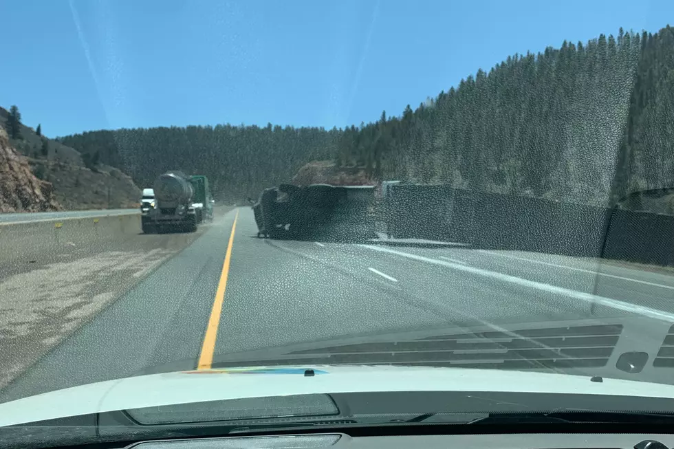
Wind gusts up to 65 mph are expected to blast the Arlington area on Interstate 80 as well as the Bordeaux area on Interstate 25 this afternoon through early Friday, before another round of snow returns.
The National Weather Service in Cheyenne issued the following statements Thursday morning:

20/210AM: Greetings! Winds will be on the increase through the day today. Very strong winds return to Arlington by mid afternoon and Bordeaux this evening. High Wind Warnings are now in effect for the Arlington area on Interstate 80, between mile markers 240 and 290, as well as the Bordeaux area (mile marker 71) on Interstate 25 through 5 AM Friday. Gusts to 65 mph are likely in these areas this evening. Strongest winds look to occur between 8 PM tonight through 3 AM Friday. There will be a EXTREME blowoff/blow over risk for light weight and high profile vehicles, including those towing camper trailers. For road conditions, refer to www.wyoroad.info. For the most up-to-date weather forecast, refer to weather.gov/CYS


20/530AM: Greetings! Here's a look at the three day forecast for southeast Wyoming and Nebraska Panhandle. Winds will be on the increase this afternoon and particularly during the evening hours, for our wind prone areas of southeast Wyoming. High Wind Warnings are in effect for Arlington and Elk Mountain on Interstate 80 as well as Bordeaux on Interstate 25. Gusts to 65 mph are likely for these areas. Another cold front pushes through tonight, that will bring fairly widespread light snow to most areas early Friday morning, persisting through much of the day. Snow comes to an end from north to south Friday late afternoon and evening. Saturday will be dry with decreasing clouds through the day. Stay tuned!
READ MORE:
- One Year Ago Today: Cheyenne Records 89 MPH Wind Gust
- WATCH: Brutal Wind Topples Semi on I-25 South of Cheyenne
The Worst Storms Of The Decade In Southeast Wyoming
KEEP READING: Get answers to 51 of the most frequently asked weather questions...
More From Y95 Country