Cheyenne NWS: Damaging Winds, Large Hail Possible Today
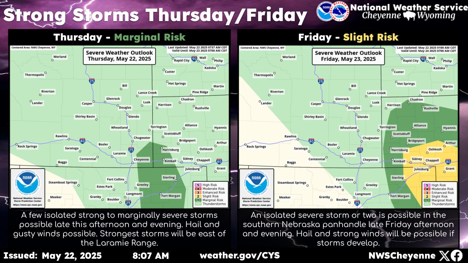
The Cheyenne Office of the National Weather Service says hail and strong winds are possible this afternoon [May 17] in southeast Wyoming and the Nebraska Panhandle.
Both Cheyenne and Laramie could see the storms, according to a map from the NWS [see below].
The agency posted this statement:
SPC has issued a Marginal Risk for isolated severe thunderstorms in portions of southeast Wyoming and the Nebraska panhandle. The main threats today are strong to severe storms producing lightning, damaging winds, and large hail. The first round of storms will likely be between 3 PM and 9 PM, with the potential for another round of storms later between 10 PM and midnight. For more forecast information refer to weather.gov/CYS.
10 Outstanding Ways To Save Money On Gas In Wyoming
Baby Bison In Thermopolis Wyoming
Gallery Credit: Glenn Woods
More From Y95 Country